
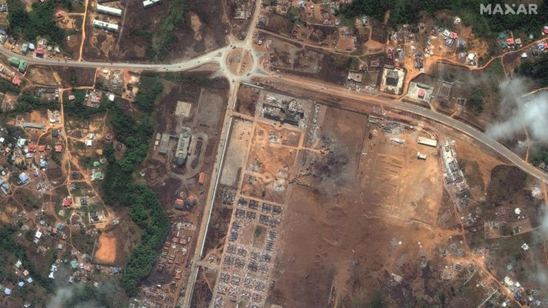
New satellite images has revealed the extent of destruction in Equatorial Guinea’s main city Bata following explosions at a munitions depot on Sunday.
The official death toll has now reached 105, with at least 600 injured.
Rights groups say the casualty figures could be significantly higher and have called for an independent investigation with questions being asked about why stockpiles of explosives were being stored in a populated area.
“Based on the number of bodies pulled from the rubble” says Human Rights Watch citing local observers, “the actual number of victims is much higher”.
Buildings inside the barracks were destroyed and people’s homes in the surrounding area were also affected. Green spaces circling the army complex were obliterated.
Analysing satellite imagery over the past two decades, it’s possible to see how the population rapidly expanded around the barracks.
When the complex was being built in 2004, it can seen on Google Earth surrounded by forest. Just under two decades later, the city has rapidly expanded into this area.
BBC